Tanzania NCAP: The Tanzanian Adaptation Programme
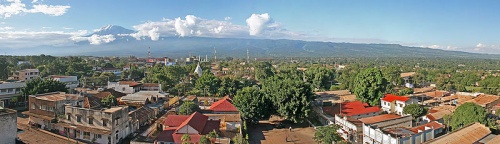
Mushi region with Mt. Kilimanjaro in the background. Photo by Muhammad Mahdi Karim
Introduction
The Tanzanian NCAP report explains vulnerability by exploring the constraints and opportunities that affect livelihoods. Two national studies, in Rufiji District and Kilimanjaro District, were completed which were overviews of agro-ecological zone adaptation, specifically with regard to crops and livestock and water supply issues.
Rufiji Valley
Resilience and vulnerability in the Rufiji valley of Tanzania are assessed in relation to locally defined poverty indicators and are heavily determined by the availability and access to capital assets.
Spanning 13,339km2 and situated 192km south of Dar es Salaam, Rufiji is the largest of six administrative districts spread along the coast of the Indian Ocean. The Rufiji district is divided up into six smaller administrative divisions, which in turn are divided up into 19 wards. In total Rufiji contains 94 villages and 385 hamlets. Rufiji has a hot climate with an average annual rainfall of between 800 to 1,000mm. It has a bimodal rainfall pattern with the short rains between October to December, and the long rains between February to May (Mwageni et. al., 2005). Seasonal floods are experienced in the lowlands during the long rains and Rufiji has historically experienced large flood and drought events every ten years. Rufiji is predominantly rural and 80% of households are dependant upon subsistence agriculture. Traditional cultivation methods and tools mean that agriculture is labor intensive and low yielding.
Tanzania’s Poverty Reduction Strategy Paper identifies the Rufiji district as a high priority because it suffers high levels of food insecurity, malnutrition and poor health statistics (PRSP, 2002). Livelihoods in the region are highly susceptible to stresses and shocks. In the National Communication to the UNFCCC, climate change scenarios suggest that river basins are expected to receive a 5 to 45% annual increase in rainfall; however, wet seasons are expected to become shorter. Increased precipitation over shorter periods of time will increase the frequency and magnitude of large floods in Rufiji. The dry season is predicted to lengthen, while average temperature increases of 3.5°C will increase the severity of drought (URT, 2003).
Predicted climate change impacts will have serious consequences for livelihoods in Rufiji. Increasing frequency and severity of floods will greatly disrupt floodplain livelihoods and cause significant damage to infrastructure (including hydroelectric power generation). Increased rainfall intensity is expected to accelerate soil erosion and nutrient leaching. Higher annual temperatures will increase soil evaporation, shorten the grain filling periods and lead to heat stress in important food crops. Changes to season duration will shorten optimum planting cycles and lead to increased crop failure (URT, 2003).
Kilimanjaro
The Kilimanjaro region is located in northeast Tanzania and covers an area of 13,209km², the smallest region in Tanzania. Despite this, it has a population of 2,097,166, giving a population density of 159 people/km². The population density varies dramatically from 650 people/km² in the highland Chagga gardens to below 50 people/km² in the lowland plains. 75% of the population lives in the rural areas and agriculture accounts for 70% of GDP for the region.
There are six districts in the Kilimanjaro region: Rombo; Mwanga Same; Hai; Moshi Rural; and Moshi Urban. Research was carried out in the Chagga gardens of Rombo and Moshi, selected for their ecological similarities and socio-economic differences. Rombo is located in the east of the Kilimanjaro region, covering 1,442km² with a population of 417,602; and people/km² of 290. The 282 population growth rate is 1.6% while the average household size is 5.6 people. Moshi Rural land area covers 1,713km² and has a population of 504,287 giving it a slightly higher population density of 294 people/km². The population growth rate is also slightly higher at 1.9% but the average household size is lower at 5.4 people.
The region has a bimodal rainfall pattern with the short rains between October and December and the long rains between March and May. Precipitation levels are differentiated by altitude, aspect and exposure on the mountain. Total annual precipitation depends on the success of the short rains and the onset, intensity and duration of the long rains.
Related Pages
Methodology of Tanzania NCAP Project
(0) Comments
There is no content