The Chiquitania fires: the role of water resources in forest restoration plans
Introduction
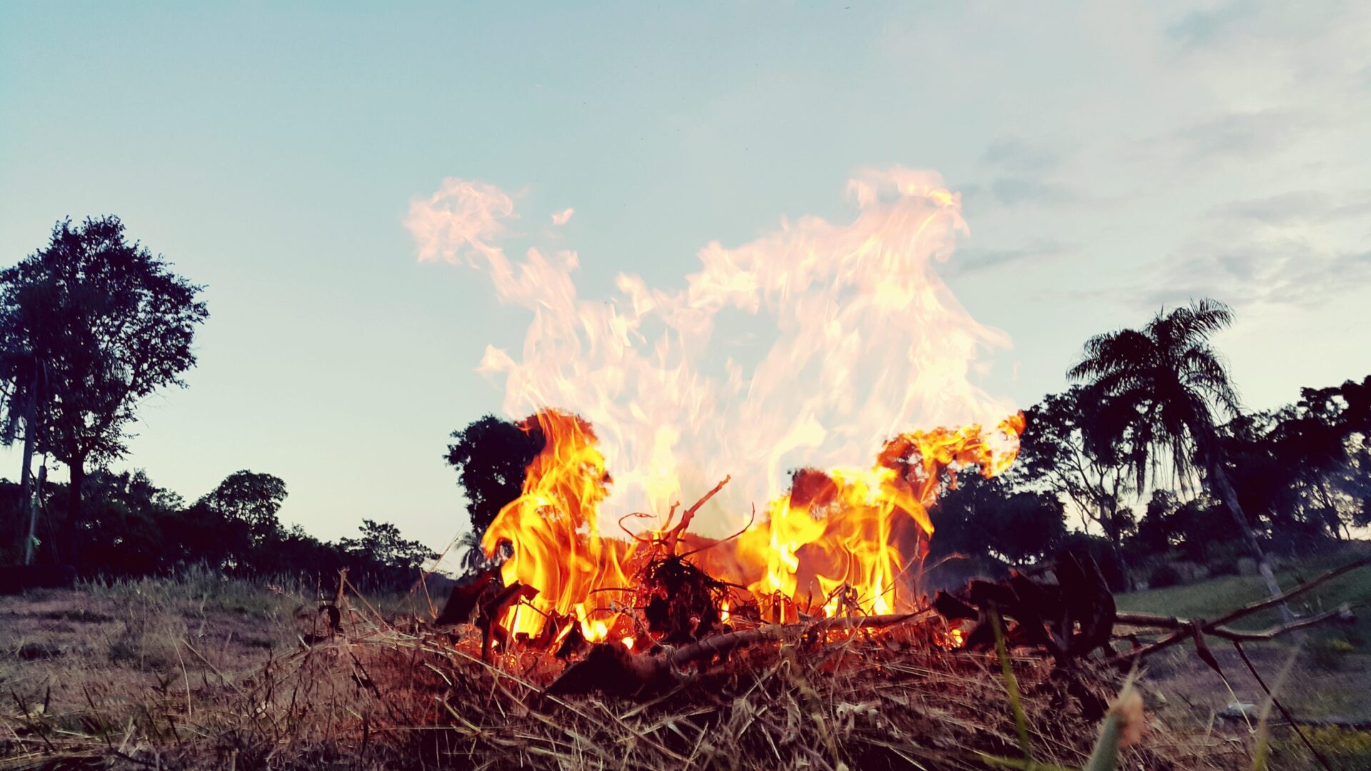
The Chiquitano Forest is the largest of the world’s few remaining dry forest ecosystems. Located primarily in Bolivia, it sits between South America’s two biggest river basins: the Amazon and La Plata.Fires occur every year in the area mainly due to regular pasture burning and ongoing agricultural expansion. But in 2010 and then again in 2019, intentional fires spiraled rapidly out of control, resulting in a catastrophic “megafires” with intensities that had not been witnessed in past decades. The 2019 event was one of the largest forest fires in Bolivian history, with approximately 3.6 million hectares burned, or almost 10% of the Santa Cruz Department.
Such events are problematic not only in terms of biodiversity loss, but also due to their impact on land cover, water resources and livelihoods. Increased forest fires and deforestation can lead to changes in the water balance, which can affect the availability of water resources in the Chiquitania Region over time.
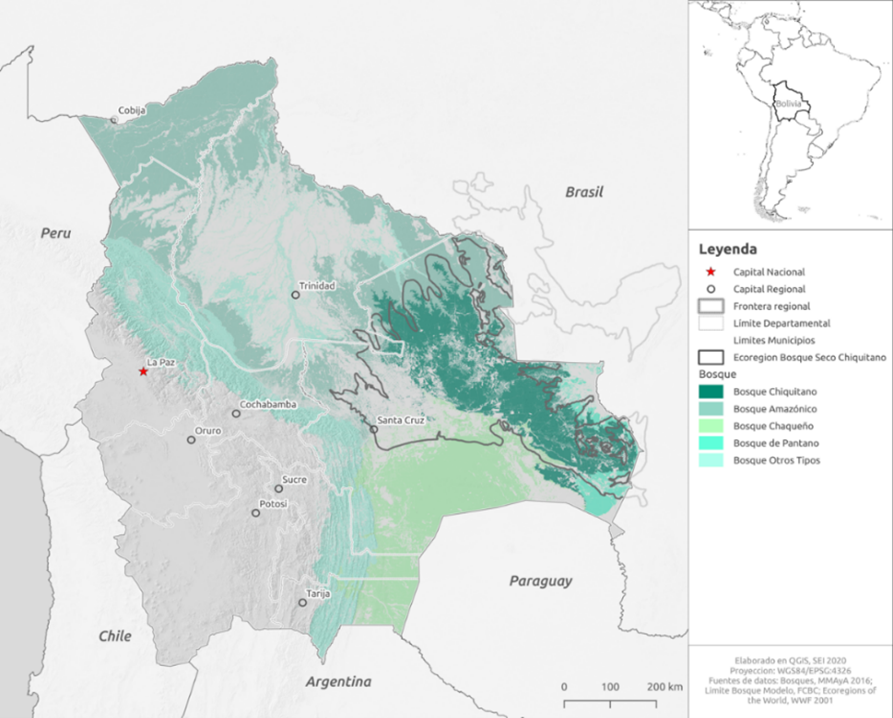
Map showing the location of the Chiquitano forest (dark green) in Bolivia and other forest types.
This project aims to help policymakers consider the watershed as the management unit for land and water resources planning, in order to enable effective forest restoration after fires in the Chiquitano Forest.
Download the full publication from the right-hand column. The key messages from the publication are provided below. See the full text for much more detail.
A framework to integrate water and forest restoration planning
In response to the 2019 fires, various regional and national agencies in Bolivia launched restoration plans, including the Santa Cruz Department (e.g., Plan De Recuperación De Las Zonas Afectadas Por Incendios En El Departamento De Santa Cruz). Most efforts are focused on socio-economic, environmental, cultural and governance actions, but none of them address water resource issues. Supported by the Swedish International Development Cooperation Agency (Sida), the Stockholm Environment Institute (SEI) launched a pilot program that would inform recovery efforts like the one in the Santa Cruz Department. We worked with key actors – such as the regional authorities, the Ministry of Environment and Water (MMAyA), local universities and the Organization for the Conservation of the Chiquitano Forest (FCBC) – to propose a framework for evaluating fire impacts and prioritizing restoration efforts at the watershed level. Our aim is to help policymakers consider the watershed as the management unit for land and water resources planning. For this project, we combined land use and fire maps from 2001 to 2019 (using remote sensing data) with watershed maps, revealing which watersheds are located in fire-prone zones and where the largest forest cover has been lost. Our prioritization tool allowed for the dynamic visualization of the burned areas and forest cover loss in each watershed. We also included water-related indicators, such as groundwater recharge areas, with the intention to pinpoint which watersheds are the most vulnerable. This work lays the foundation for future modelling using the SEI’s Water Evaluation And Planning (WEAP) tool. The more vulnerable is a watershed, the greater is the priority for a detailed, regional-level WEAP model that can quantify the impacts of forest cover loss on water resources.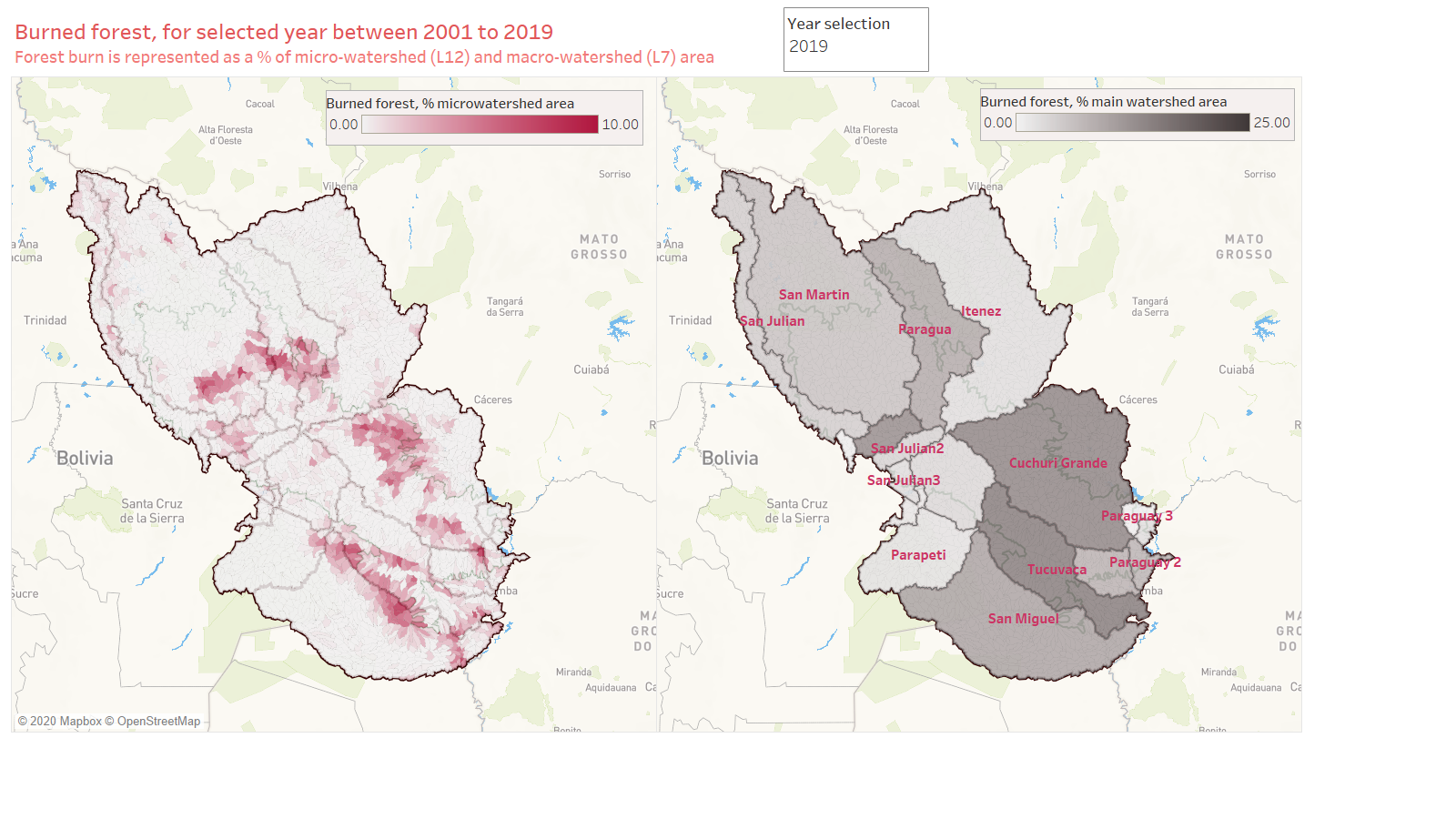
Prioritization tool in Tableau summarizing forest burns in 2019 as percentage of the microwatershed area (left) and macrowatershed area (right).
Fire effects on watersheds
The mapping efforts showed how fires are associated with forest cover loss and the advancing of the agricultural frontier. The conversion of forests to cropping areas has been progressing steadily since 2001 and more rapidly since 2016. However, forest fires do not automatically mean that the forest land cover is lost and immediately converted to agriculture.
SEI’s visualization tool helps distinguish between fires occurring in watersheds where the forest is still intact, versus fires in watersheds where the forest cover has already been lost. It can identify which watersheds were most affected by the 2019 megafires in terms of burned area, as well as which watersheds suffered the most total burns in the 2001-2019 period. The tool also identifies the areas that have lost the largest amount of their forest over the past 20 years. Emphasizing the conservation of intact forest landscapes and protected forest areas might prevent future losses of Chiquitano forest and mitigate the severity of the impacts on water resources.
In terms of groundwater recharge, watersheds in the northern Chiquitania region have the largest recharge potential and number of groundwater wells. These watersheds have not been as impacted by the forest fires so far, but are still worth considering and prioritizing in terms of water resources.
Next steps
SEI plans to further develop the prioritization tool with more criteria, such as ecosystems relevance, proximity to protected areas, presence of local communities, and population size. We also plan to use a participatory approach to understand how local stakeholders value the various criteria for prioritization.
SEI aims to develop a regional-scale model of higher temporal and spatial density that looks at both surface water and groundwater to further study the hydrological impacts of forest fires on groundwater resources in the Chiquitania region.
Suggested Citation:
Wickel, B., Fernandez, J. and Escobar, M. (2020). The Chiquitania fires: the role of water resources in forest restoration plans. SEI brief. Stockholm Environment Institute.
Related resources
- Assessment impacts and adaptation options to forest fires
- Análisis espacial y multitemporal de la dinámica de los incendios forestales entre los años 1986-2012 en la cuenca de Zapocó, Sa
- Future impacts of climate change on forests
- Integrating ecosystem-based adaptation and integrated water resources management for climate-resilient water management
- Mountain forests management and its relationship with Andean population well-being: The experience of the Andean Forests Program
(0) Comments
There is no content