Mauritius : Sea-Level Rise and Impacts in Africa, 2000 to 2100. Application of the DIVA model to Africa.
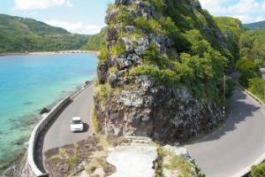
Coastline in Mauritius. Image: © mauritius-islander.com/
Impacts of sea-level rise in Mauritius
The Republic of Mauritius is a group of 20 small islands with a total land area of 2,040km2 and a population of 1.2 million (2007 estimate, Times Book, 2008). Mauritius is surrounded by coral reefs. It enjoys a maritime tropical climate and is predominantly an agricultural country, listed as one of the most densely populated agricultural islands in the world, and hence a considerable pressure on land (Ragoonaden, 1997). Sugar cane is the dominant crop covering 45% of the total land area. Light manufacturing also contributes to the economy. The coastline is approximately 200km long with a 243km2 shallow lagoon area which makes it an ideal location for tourism, such as boating and snorkelling (Ragoonaden, 1997). The beach width varies from a few meters (in eastern and southern regions) to 25m (in the north-eastern regions). Mangroves are present around river mouths and estuaries around the south west region of the main island (e.g. Terre-Rouge, Riviere Noire Baie du Cap, Riviere du Rempart) or in the eastern region (e.g. Trou D’Eau, Douce, Poste La Fayette, Bras D’Eau, Roches Noires, and Poudre D’Or) where there is a fresh water source near the sea. These mangroves help protect the coast from erosion and dampen the action of waves on coastline and contribute in retaining terrigeneous sediments from affecting lagoons (Appadoo, 2003). Coastal wetlands are located mainly in the northern and north-western areas and play a vital role for the coastal ecosystems providing essential habitat for many important marine lives (for example fish, shrimp, cabs, birds etc.). Together with its beautiful sandy beaches, the islands are a popular tourist location, where tourism contributes 3% of GDP. However, the coastal zone is degrading at an alarming rate, and beach erosion threatens coastal infrastructures (such as coastal roads and tourist hotels) due to many natural and anthropogenic factors associated with increased population growth, leaving the tourism industry at risk. Lack of coastal management, disorganized construction of jetties and groynes and removal of sand for construction purposes also contribute to the risks. Accelerated sea-level rise will undoubtedly worsen the problems in terms of loss of lowland through submergence, beach erosion, damage to coastal infrastructure and loss of wetlands (Ragoonaden, 1997).
With 1m of sea-level rise, it is estimated that around 26km of beaches would disappear on the west coast, also including flooding of local housing, and tourism & infrastructure facilities. Inundation will also affect plantations and major coastal road links (Beebeejaun, 2000). In conclusion, Mauritius needs further investigation in terms of climate change impacts. In addition, it is important that coastal management is developed, and this also needs to include consideration of sea-level rise and climate change
Suggested citation
Brown, S., Kebede, A.S., and Nicholls, R.J. (2011). Sea-Level Rise and Impacts in Africa, 2000 to 2100. University of Southampton, UK, 215pp
(0) Comments
There is no content