Paloma Esteve
How can irrigated agriculture adapt to climate change? Insights from the Guadiana Basin in Spain
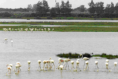
This paper illustrates a systematic analysis of climate change adaptation in the Guadiana irrigation farming region.
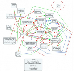
Developing a social network map to frame adaptation action in the Guadiana river basin, Spain
Developing a social network map to frame adaptation action in the Guadiana river basin, Spain
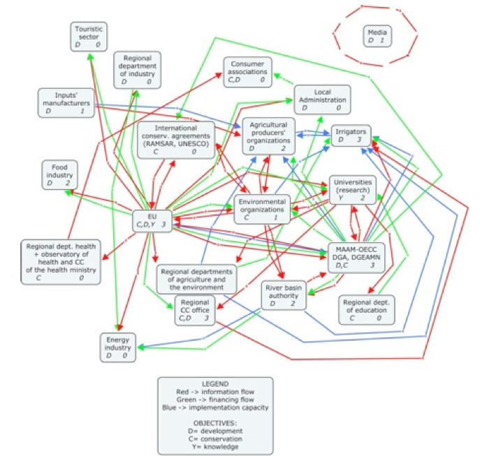
Developing a social network map to frame adaptation action in the Guadiana river basin (Spain)
Results of a social network mapping exercise with stakeholders in the Upper Guadiana basin.