Step 2: Assessing Conditions and Trends
Guiding question: What are the major climate variables of concern currently? How do there vary spatially?
In a national study, highlighting the location of specific hotspots in the country where climate-related hazards are experienced or likely to be felt is a key step in identifying intervention areas. The initial screening process begins with identification of the main climate issues in the country or region of interest.
Process
If the aim is to provide spatial context using a Geographical Information System.
- Import databases into GIS software.
- Identify project sites and similar regions. Identify locations and spatial extent of major climate hazards. Locate vulnerable groups. See the Guidance Document: Technical_Support_to_Facilitate_Step_2_of_the_NAPA_Process.pdf
- Assess current concerns in historical climate context
- Identify hotspots where higher-resolution work should be conducted
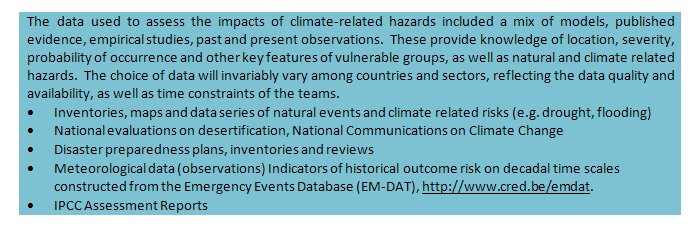
Data Sources
Data sources for assessing conditions and trends
Related Pages
Step1: Identify Climate Vulnerability Exposure
(0) Comments
There is no content