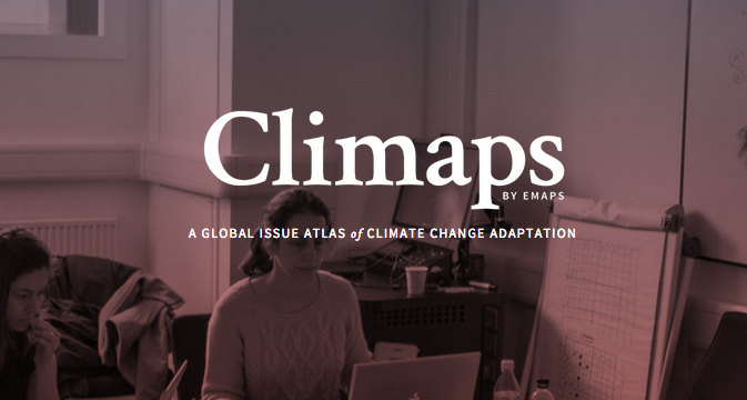
Climaps – a Global Issue Atlas of Climate Change Adaptation
How can digital technologies in data visualisation help scientists, journalists, activists, corporations and citizens to improve their participation in contemporary techno-scientific debates?
Climaps.eu is an online atlas providing data, visualizations and commentaries about the climate adaptation debate. It contains 33 issue-maps. Each of the maps focuses on one issue in the adaptation debate and provides:
- an interactive visualization;
- a discussion of the map and the findings that it discloses;
- a description of the protocol through which the map has been created;
- the raw and the cleaned data on which the map is based and
- the code employed to treat them.
Climaps also contains 5 issue-stories guiding users in the combined reading of several maps.
The atlas aims to address climate experts (negotiators, NGOs and companies concerned by global warming, journalists…) and to citizens willing to engage with the issues in climate adaptation.
It employs advanced digital methods to deploy the complexity of the issues related to climate adaptation and information design to make this complexity legible.
The Climaps website presents the results of the EU research project EMAPS. weADAPT is featuring three of Climaps’ issue stories. To read them, please click on any of the links below.
- Climate Adaptation in Bangladesh – A case study on tracking adaptation funding.
- Mitigation and Adaptation in the UNFCCC debates.
- A closer look at the practices of vulnerability assessment and the priorities of adaptation funding.
About EMAPS
EMAPS (Electronic Maps to Assist Public Science), a 3-year research project funded by the EU, advanced an innovative method called ‘controversy mapping’ to visualise the main actors and controversies around two major scientific debates: an ageing population and climate change adaptation.
The EMAPS project was designed to assess the opportunities and risks in the use of the web and the social media as a meaningful tool to foster participatory communication between scientists and the different publics of science and technology. It draws on a set of theories and scientific practices ranging from digital methods to climate science.
The project was coordinated by Sciences Po Paris. Its partners were the University of Amsterdam, Barcelona Media, Politecnico di Milano, the Young Foundation, and the Dortmund Technische Universität.
See (and cite) the Summary for Policymakers of the project:
Climaps by EMAPS in 2 Pages (A Summary For Policymakers and Busy People in General) Venturini, Tommaso and Meunier, Axel and Munk, Anders Kristian and Borra, Erik K and Rieder, Bernhard and Mauri, Michele and Azzi, Matteo and Ciminieri, Daniele and Uboldi, Giorgio Roberto and Kaltenbrunner, Andreas and Laniado, David, Climaps by Emaps in 2 Pages (A Summary for Policy Makers and Busy People) (December 2, 2014).
Methodology
The methodological foundations of the project were laid out through the mapping of the ageing population debate. A background analysis of the debate was prepared for an in vivo test of the debate mapping tools.
EMAPS observed and documented the interactions of 30 alpha-users with an atlas of 25 visualisations during three meetings, where the users were confronted with the maps and asked to make use of them. The project used novel design solutions to represent large quantities of data in a legible form while the group of alpha-users was selected to include representatives of all the groups concerned by the ageing controversies, and in particular, representatives from academia, business and civil society organisations. At end of each meeting, the feedback and the comments made by the users’ group were used to enrich and re-design the map in a series of iterations. Users were also invited to explore the use of the maps for professional purposes such as networking, fundraising, communication, and strategic planning.
The second half of the project was dedicated towards the production of a platform that visualises sub-issues on climate adaptation. The information was collected together in the form of an atlas, comprising geographical maps, timelines, diagrams, argument trees, networks of alliances and oppositions. These were integrated into several narratives which hope to make the debate on climate adaptation readable for a larger public. Below is one of the visualizations from the Climaps’ issue stories.
Top Issues On The International Climate Change Issue Agenda According To The Web.
Expected Final Results and Potential Impact
According to the initial findings, the methodology developed in the EMAPS project supports the establishment of a qualitative relationships among the actors of a techno-scientific debate and fosters discussion among them. The method could be a breakthrough in the quality of the dialogue that can be established between the different stakeholders. It could be used to encourage the development of a particular political attitude towards science and technology and towards the web as a public space.
The participation of the public in debates on science and technology is limited by the high cost of learning the experts’ knowledge in order to understand the issues at stake. Alternatively, EMAPS implements an approach to public engagement based on the understanding of the full extent of disagreement between the experts. Equipped with visual and digital tools to deal with scientific uncertainties and experts’ divergences, the public can learn to take part more productively in the scientific debate.
(0) Comments
There is no content