Current vulnerability in the Virunga landscape, Rwanda
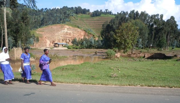
Introducing more trees into the farmed landscape would assist the landscape in coping with climate change. Credit: Charlotte Pavageau, CIFOR.
Project summary
A regional baseline assessment to analyse vulnerability was conducted in five landscapes of the Congo Basin as part of the ‘Climate Change and Forests in the Congo Basin: Synergies between Adaptation and Mitigation (COBAM)’ project (2011/12). The following information gives a summary of the results for the Virunga landscape around Volcanoes National Park in Rwanda along the borders of Uganda and the Democratic Republic of the Congo (DRC).
Using a participatory approach, a vulnerability assessment was conducted, this included understanding both the past trends and present conditions in relation to social context and their interactions with natural resources. The methods used to generate information for the various vulnerability dimensions include literature reviews, historical analysis of climate and hazards and participatory workshops.
*This article is an abridged version of the original text. Please note that references have been removed.For more detail, full references, and to quote text please use the brief available for download on the right.
Key messages
The following is a summary of the key outcomes of the project
Local perceptions of change
Local perceptions captured during focus group discussions aimed to explore changes from the 1970s to the present. Among the historical disturbances, participants highlighted conflicts and political and social changes because of their impacts on famine, over-exploitation of natural resources and livelihoods. They noted that the mass exodus of hundreds of thousands of refugees took its toll on the environment. The establish community justice system had implications for social organisation and indirect impacts on land rights and access.
Differentiated vulnerability
Each climate‑related disturbance affects different groups, natural resources and activities differently. The results show that the community groups that directly depend on the park and other natural resources were more severely affected by destructive disturbances, such as strong winds, which destroy houses, fields and produce and this was reflected through their income and poverty level. A higher dependence on natural resources and lower dependence on livestock contribute to these differences. Other studies show that Batwa around Volcanoes National Park have the least livestock of all groups, owning on average 1.04 animals compared with 2.73 for other groups in the community.
Dynamics of ecosystems
Volcanoes National Park constitutes almost the only reservoir of forest biodiversity in the area. The restriction on uses imposed by the park limits the interactions between the communities and the forest. Dependency on the park resources is higher for Batwa groups. In particular, 28.8% of the Batwa households stated that they collect fuelwood from the park, compared with only 0.4% of the rest of the community. Nevertheless, exploitation in the park seems to have decreased in recent years because of a reinforced conservation programme and interventions initiated with communities. Land uses in the region have changed rapidly in recent decades due to the demographic evolution, waves of migration and side‑effects of the civil war.
Current adaptive capacity
The landscape is mainly domesticated and natural forest resources do not make a major contribution to local livelihoods. Most of the safety nets during periods of stress are developed outside the forest through efforts to diversify activities. Infrastructure, land use planning and domestication of the landscape constitute other main responses to the stresses (e.g. use of terracing, channeling of water flows, improvements to roads, installation of water tanks).
The gorilla‑based conservation scheme has been a tremendous factor behind economic development in the region and is largely held up as a success story in Africa. Increased devolution of authority to the local level and shifting of responsibility to local communities have contributed towards the strengthening of adaptive capacity in the region. However, the level of returns for the local population is not equivalent to the increasing population pressure, lack of opportunities for most of the population and poverty. Restrictions on access to natural resources and poor access to land for marginalised groups have actually increased their vulnerability.
Looking ahead
Possible approaches to improve adaptive capacity include fostering agroforestry and restoring abandoned lands. However, as the shortage of available land prevents the establishment of large plantations, strategies need to be developed for marginal lands, and would then require coordination of multiple individual activities.
Pilot projects, such as those supported by the COBAM project, could lay the foundations for longer‑term solutions, as long as there is systematic learning that enables reflection and refinement along the way. This will require mechanisms to support the learning process and enable experimenting, monitoring and improving over time. The insights generated through the vulnerability baseline assessment in the Virunga landscape will be combined with more in‑depth research to generate recommendations to inform decision‑making and planning at local and national levels across countries in the Congo Basin.
COBAM
Citation:
Pavageau, C., Butterfield, R. and Tiani, A. ( 2013). Current vulnerability in the Virunga landscape, Rwanda. CIFOR.
(0) Comments
There is no content