Adaptation Toolkit
Climate change vulnerability assessment and adaptation planning (V&A) is gaining attention in least developed countries where many people, infrastructures and ecosystems are exposed to variability and long-term changes in the climate and have low capacity to cope, respond or recover from related impacts. This interest is creating a need for knowledge, skills and tools to support V&A. While several tools for V&A have been developed, these tools are not readily available, especially for local organisations and research individuals in these countries, and there is a need to contextualize and tailor them to local needs. For instance, the use of tailored participatory tools ensures exchange of knowledge on climate variability between researchers and local people and this contributes much to making adaptation choices.
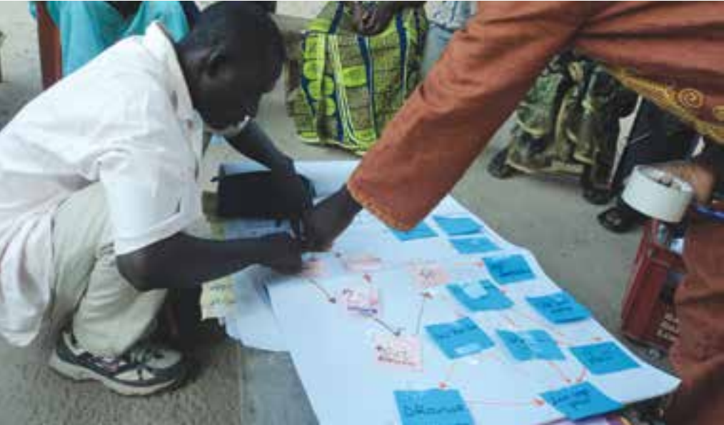
In most cases in Africa, the responses of local communities to the impacts of extreme climatic events have mostly been reactive instead of proactive due to unpreparedness. Adequate preparations for these extreme events can be informed by research at all levels. For this reason, through a joint collaboration between ENDA, SEI and local partners in Gambia, a toolkit for V&A has been co-developed, tested and refined for its use by local practitioners in developing countries. The toolkit also contains examples of tool testing and application in Gambia. This joint initiative is supported by UNITAR through the C3D+ project.
The table below presents an outline of the tools in the toolkit. These tools were selected on the basis of their ability to guide researchers and practitioners in the implementation of a participatory climate vulnerability assessment that can inform adaptation choices at the community level. When used in combination, the tools in this toolkit help to examine the differentiated exposure of a social group, resource or activity in the community to impacts of increased climatic variability or extreme events, as well as the local current adaptive capacity in the community. More so, results generated through the application of these tools could inform policy makers to take adaptation decisions at the local level. Each tool in the toolkit could be used as a stand-alone tool, but we recommend using them in combination to fulfil different needs in the assessment and planning process. Ideally, these tools could be used in the sequence in which they are presented in this guide. This order allows to gain a systematic understanding of a study area, its vulnerability to climate variability and extreme events through to the identification of adaptation options. However, users may make a selection of the tools based on their study objectives. The table below presents an outline of these tools and their expected outputs. More detail on each tool is available by clicking on them.
|
DESCRIPTION OF TOOLS |
OUTPUT |
|
This tool helps to identify or set boundaries to the area you will assess and maps out available biophysical resources and their spatial distribution. It generates discussions around issues like land tenure, resource allocation and management, use and benefits obtained from the resources, and relationships between the different resources. It provides a good basis for discussing what generates climate vulnerabilities and/or the capacity to adapt. |
A map showing the study area, available resources and their geographical distribution, and identification of key factors that shape the relationships between the social actors and the biophysical resources in the site. |
|
This tool identifies various capacities, skills and assets in community / stakeholder group / project site that could be further strengthened and built upon for future adaptation. |
A graphic overview of available capacities, skills and assets on site. |
|
Trend analysis and historical disturbance matrix: This tool helps to identify climate-related events that have affected the area in the past, either positively or negatively, as a basis for understanding current vulnerability. |
A timeline and a table showing and describing past events/disturbances at the site, consequences and coping strategies. |
|
Current vulnerability mapping: This tool helps to establish the degree and range of impacts of different climate hazards on resources, livelihoods and social groups. |
A picture showing the main climatic hazards affecting the project site and who/what is affected to what degree of severity. |
|
This tool assesses the community’s perception of climate change. It helps to bring out and make explicit what local people view as being the drivers and consequences of climate variability and change. |
A narrative of varying views on the dynamics of the climate change phenomenon so that these can be further discussed, debated and compared with available scientific data. |
|
Participatory scenario building: This tool aids community members to plan for the future and make adaptation decisions based on their past experiences, current capacity and available assets, and the vision and goals they have for the future. |
A consensus view on possible adaptation options drawing on historical experience and current capacity but with an explicit focus on how things might develop into the future. |
|
Climate Adaptation Options explorer (ADx): ADx is a decision support tool to screen adaptation options. Users are able to access several methods to select the most appropriate and widely preferable adaptation options for their site. See also example application in the Greater Banjul Area in Gambia.
|
A subset of identified adaptation options that can be prioritised for implementation because they satisfy multiple criteria and preferences. |
Local Research: Good Practices
Synopsis of the case study
A case study was used to test and refine the toolkit. We focused on the Greater Banjul Area in Gambia, which is located in the far west of Africa, on the Atlantic coast. The country shares all borders with Senegal, being almost entirely surrounded by Senegal except for a small stretch of coastline. Gambia’s total land area is 11,300 km2 with 1,300 km2 covered with water (River Gambia). Lying along the Sahelian West Coast of Africa, it is located between latitudes 13o N and 14o N, and longitudes 13o W and 17o W. The country is exposed to three main climate-related threats. The first is sea-level rise, which leads to shoreline retreat and saline intrusion into soil, underground water and also the River Gambia. The second climate hazard is increasing temperatures contributing to heat stress, especially in the months of August, September and October. Thirdly, there is also erratic rainfall that is observed to be contributing to seasonal floods.
Two pilot communities (Lamin and Ebo town) within the Greater Banjul Area (GBA) were chosen for this case study. These communities are exposed to almost all the above-mentioned hazards with the most serious one being seasonal flash floods resulting in the destruction of infrastructure and soil erosion.
The purpose of the study was to:
(1) Assess how vulnerable people are to these climate hazards and to identify appropriate adaptation strategies in response.
(2) Contribute to the enhancement of institutional capacities within the country to undertake climate vulnerability assessment and adaptation planning.
(3) Test the adaptation toolkit and refine it based on experiences of this study.
From the process of testing and refining the toolkit in the context of this case study, we identified some good practices for local research:
Political collaboration and approval
Research activities started with a first field visit to engage stakeholders, identify local partners and to select pilot zones. Relevant stakeholders from different sectors (both national and sub-national) were engaged. Through these stakeholder engagements the study was introduced, highlighting the participatory tools to be used. Following this, the case study benefited from the collaboration of both government and non-governmental institutions. Apart from the institutional support, the collaboration also offered a chance of accessing relevant materials and data for the study. Also, the engagement of policy-makers throughout this case study created a potential avenue to influence policies with the research outcomes especially at the local level. One advantage, not to be overlooked, was the active engagement of these stakeholders in the refinement of the toolkit.
Local institutional ownership and inclusiveness
Local partners were identified to lead the in-depth field research activities. This was very useful especially as the use of participatory tools needed lots of interactions and discussions with respondents. These local organisations are normally well equipped with personnel who are able to facilitate discussions in local languages to enhance good understanding among community members. In this study, our local partners were very instrumental in the selection of the two pilot sites and the introduction of the case study to local ‘gate-keepers’. This was very helpful in preparing the community ahead of the research activities, enabling them to be ready for the discussions since participatory tools take much time and therefore the need to inform respondents well in advance.
Also the engagement of local partners promoted a good response to the study as members identified themselves with the leaders thereby assuming local ownership of the initiative.
Local capacity building
Stakeholder capacities at both the institutional and community level were enhanced through the use of the toolkit. To ensure accurate application of the tools hands-on training was given to local partners. They were taken through a step-wise process of all the tools, which enabled them to be comfortable with using them. This also gave them some practical experience of the kind of responses to expect from respondents and how best to explain each subject of discussions in their local languages.
Shared knowledge among community members
The use of these participatory tools encouraged knowledge sharing among participants throughout various discussion sessions. Some local knowledge on historical experiences was transferred from the elderly to the youth. It was inspiring seeing community members trying to identify a local name for climate change and identifying its influential factors and effects in their local dialect. These participatory tools also provided opportunities for researchers to share their scientific knowledge of climate dynamics with the local community. The knowledge acquired using these tools helped community members make informed adaptation plans when required to do so.
Tools Application: Lessons Learned
- The step-by-step introduction and instructions on using each tool in this kit made it more comprehensible and easily applicable in the field with local community members. It gave researchers opportunities to initiate interesting discussions about how vulnerable the community is to the impacts of climate change, what the specific pathways are that lead to negative impacts and what can be done to reduce these.
- The tools are user-friendly making them applicable in many climate change studies across different sectors at all levels. The advantage of this toolkit is that it has been tested in the field and refined on the basis of feedback from the users and participants.
- By using these tools in different case studies it has been realised that it is very important to follow ongoing discussions during the use of each tool. This is to ensure that expected outputs are rightly met and questions correctly answered through each step of all tools.
- It was identified that the assessment of community perceptions on climate change (tool 5) helps in uncovering the local understandings of variations and changes in the climate but this does not necessarily arrive at the factors that have been scientifically proven. In other words, the researcher should not expect local people to come up with climate change factors that are proven by hard science. However, the outcome of this activity does help to identify local knowledge that can be discussed further in relation to the available science and as a basis for identifying possible adaptation options.
- The ADx tool is very useful for decision makers (at all levels) especially in developing countries where there are limited resources for implementation of adaptation strategies. The ADx provides an opportunity to screen and prioritise proposed adaptation options, which enables possible implementation of adaptation actions amidst limited resources. Applying the tool also helps to reduce the risk of mal-adaptation.
- Unlike the other tools mentioned in this toolkit, which entail applying different participatory exercises with community representatives, the ADx requires involving also local decision makers /community leaders, in the process to enable many reflections to be made especially during voting sessions and the discussion of the results to inform adaptation decisions.
- Being computer-based, it becomes challenging to run the ADx in areas without access to computers, and it requires local researchers/ practitioners applying the tool to be computer literates and be familiar with the tool before its implementation. It also requires them to be able to have the adaptation options documented in XML format to run the ADx.
Suggested citation:
Ampomah, Gifty, and Tahia Devisscher. 2013.Adaptation toolkit: guidebook for researchers and adaptation practitioners working with local communities.Energy, Environment and Development (ENDA)
(0) Comments
There is no content